Premise
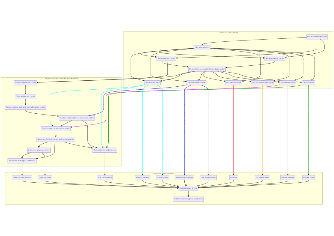
The whole map processing workflow
Preparing the elevation model
The initial input for a map is the Digital Elevation Model (DEM) which represents the elevation of the area covered by the map. This raw DEM is subjected to several pre-processing steps (Hydrologic conditioning). First, a smoothening filter is applied to eliminate noise in the data. Then small single-pixel pits are filled up to remove smaller depressions. If a map uses waterbody data, these waterbody areas are used to flatten the DEM to remove further noise. Rivers and open sewage channels when provided are burned (artificially lowered) into the DEM to enforce known drainage paths. Finally, the remaining DEM depressions are then filled with a Priority-Flood algorithm to ensure that each DEM cell drains into another.
Calculating the drainage lines and basins
From this pre-processed DEM, the gravitational water flow direction can be determined along the elevation gradient (using the D8 algorithm). The flow direction is used to further calculate a flow accumulation - representing where water accumulates. From the flow accumulation, the upstream waterways - also called “drainage lines” - can be derived. Each segment of a drainage line (between its upstream and downstream junction points) has an associated catchment. Any drop of water that falls within this catchment will flow down towards its related drainage line. By default all drainage line segments and their corresponding catchment basins are calculated. These catchment basins are then intersected with a population raster to derive the given population value living within the basin. This population count is also associated to its drainage line. This allows to accumulate population counts along the downstream path of drainage lines.
Delineation of sites watersheds
To calculate the watershed for a given site (point), we calculate the area upstream of that point by using the pre-processed flow direction. This area gets intersect with the population grid to derive the total population associated with it.