Map processing parameters
Map processing relies on a set of parameters. Here we describe what and how these parameters can be tweaked. The underlying toolbox used to process the maps are the Whitebox tools: https://www.whiteboxgeo.com/
To consider:
Open channel / sewage network vs. a closed network. An open sewage network’s flow follows surface elevation, while the flow of a closed sewage network is declared by the editor of the map.
Sewage network clean-up (yes/no) and strength.
DEM smoothening filter algorithm and strength. Available algorithms are: none, mean, median, gaussian blur, preserve.
Single-cell pit removal strategy. Available strategies are: fill, breach.
Stream burning strategy and strength. Available strategies are: relative, absolute, fill-burn and topological.
Removal of artificially raised values along riverbeds (such as bridges).
Snapping distance of sites to nearby waterways.
Water accumulation threshold for a pixel to be considered part of a drainage line, with/without standard deviation stretch (normalization step).
Catchment buffering distance around closed sewage lines.
Sewage line metadata
The metadata for sewage lines has a big impact on the map processing. The main parameters are: open, closed, trunk.
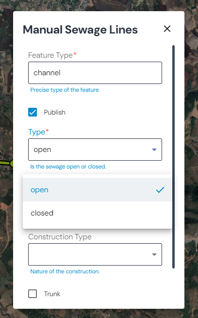
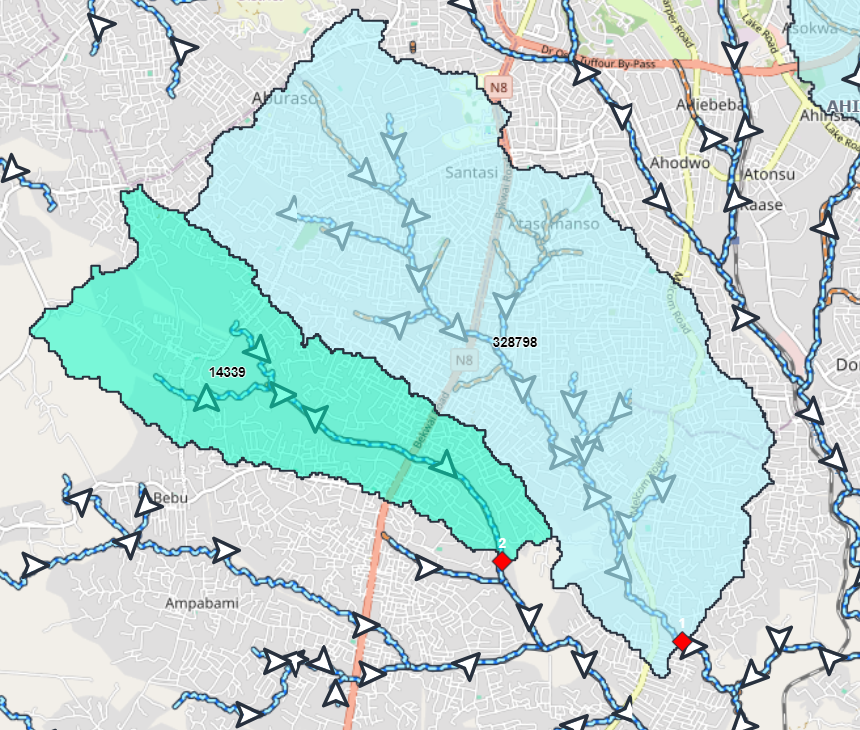
Open sewage lines
The DEM is used to infer the flow direction of open sewage lines. Here is an example of an open sewage delineation, using the DEM to infer the sewage flow:
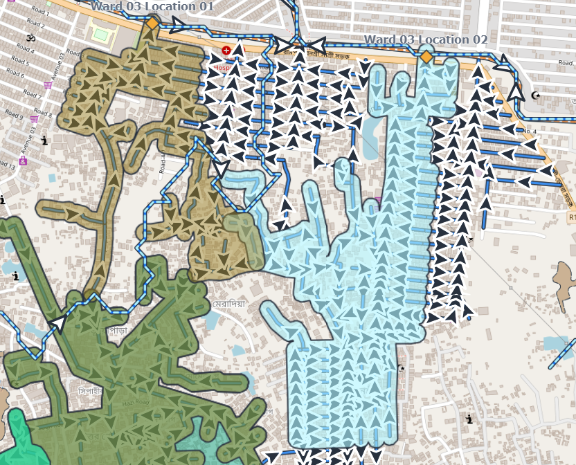
Closed sewage lines
Only the direction of the digitized closed sewage lines is used to infer the flow direction. This can always be used when the direction of a flow is known or when the flow does not follow the slope of a DEM (for instance underground sewage and / or flow from pumping stations). Here is an example of a closed sewage delineation:
Important
In this case, the sewage lines are buffered with 30m on each side to consider that everyone within this distance on each side of the sewage line is likely to contribute to that line.
Trunk lines
This attribute should be used in cases where pumping stations pump sewage via a trunk line over / under other sewage lines but there are no junctions where the segments cross.
This way, a pipeline can be isolated from the other flows, as shown in this example:
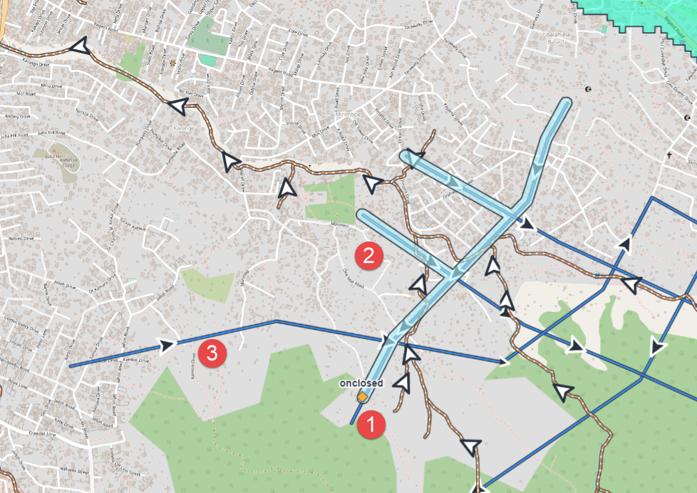
This is a site location with upstream closed sewage pipes
The watershed created takes into consideration all the pipes that intersect upstream
This segment has been labelled as ‘trunk’ segment and thus the intersection is not counted